Identify
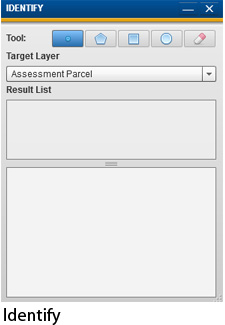
The identify widget allows the user to get more information about Assessment Parcels, Ownership Parcels, Roads, Jurisdictions, County Forest Tracts and Address Numbers.
Identify is completed by clicking a point, or drawing a shape, using the tools at the top of the widget to select how you would like to identify.
To Use the Tool:
Select the tool (how you would like to identify)
Select the layer you would like more information about using the drop down list.
Click on the map if you have selected the point tool or draw a shape on the map.
The results will be shown below in the results list. Click the result to highlight the feature on the map.
The attributes of the result will be shown below the results.
If you wish to export the results to excel click the "Export Results as CSV" and save the file locally to your computer.