Basemaps
Basemap Types
There are three different basemaps available for users to toggle between in the maps.simcoe.ca application: imagery, topographic (topo) and streets. Each of these basemaps provide a different view of Simcoe County and can be used in conjunction with layers under the advanced modes.
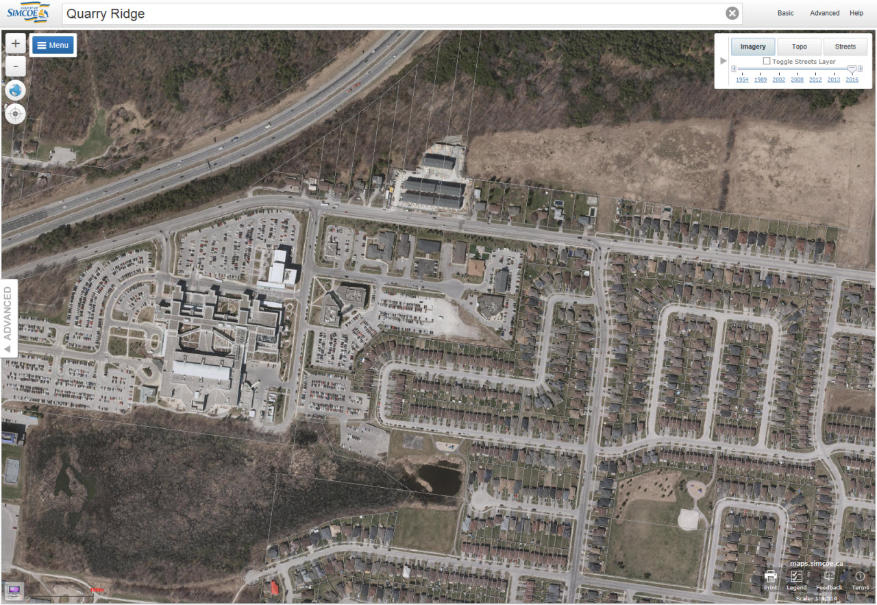
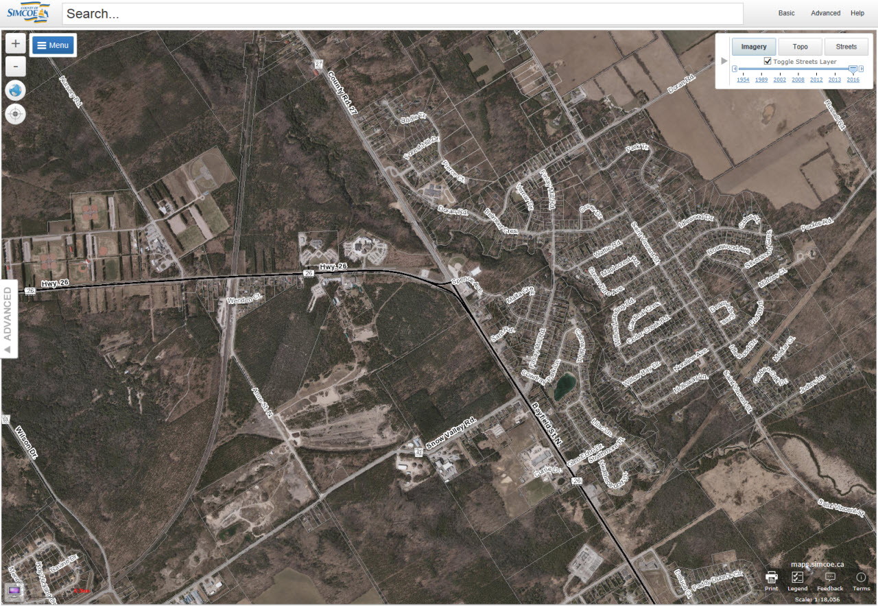
Imagery
The imagery basemap allows users to view aerial photographs of the County of Simcoe. When the Imagery basemap is active the imagery slider is available allowing users to move between aerial photography from different years.
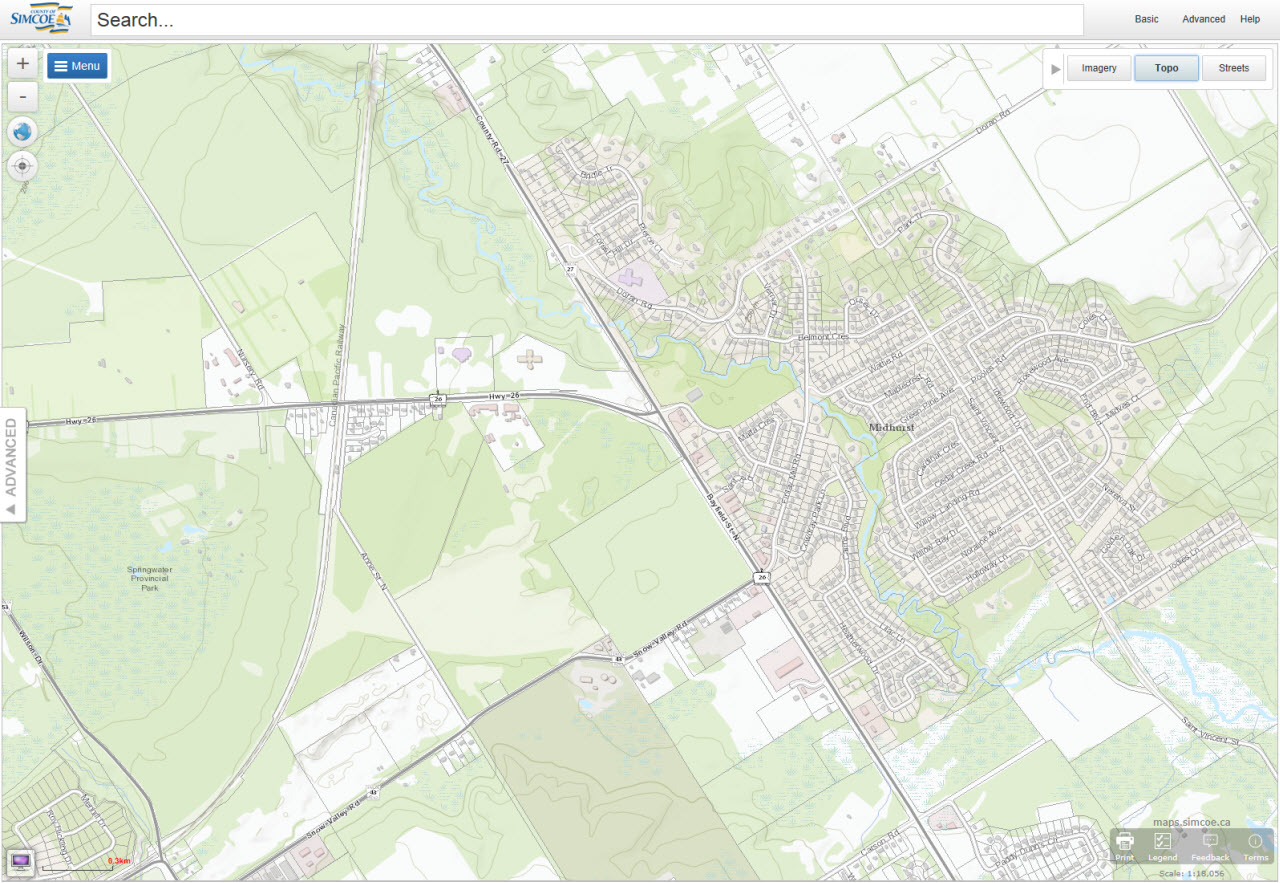
Topo
The topographic basemap is the most detailed basemap showing features such as buildings, contours, streets, address numbers, schools, wetlands etc. This is the default basemap when the application is opened.
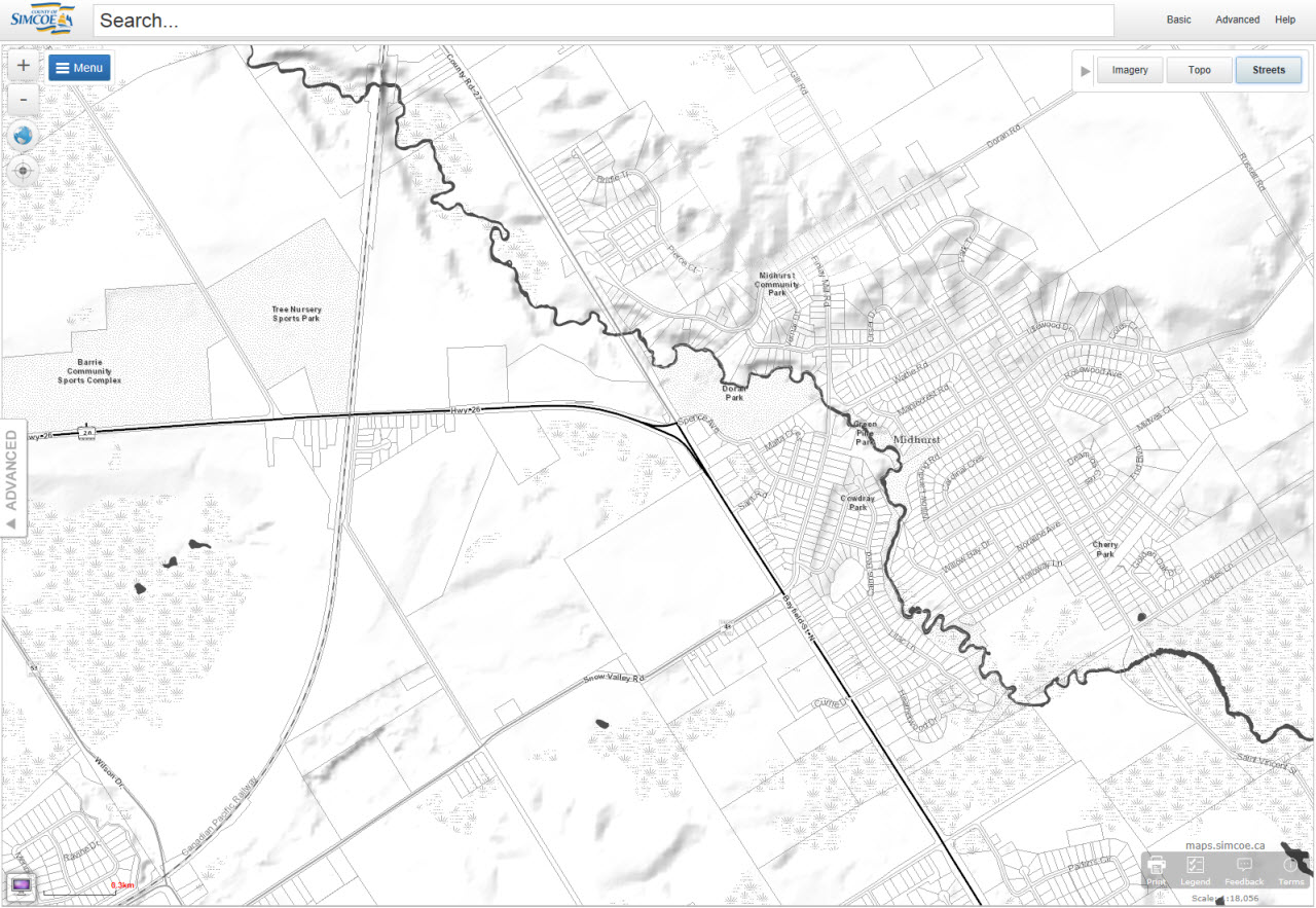
Streets
The streets base map is a basic black and white map which is meant to allow for markup and other information to be the centre of attention. This basemap is great when used with the drawing tools.
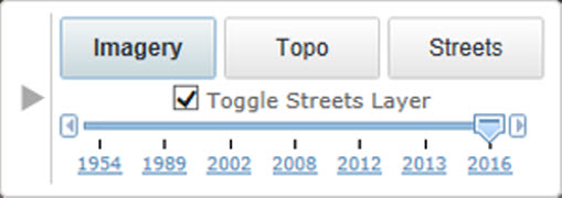
Imagery Slider
The imagery slider is available to users when they are viewing the imagery basemap. The imagery slider allows users to move between aerial photos taken during various years. The imagery slider also has a streets layer toggle which allows users the ability to view aerial imagery without any roads displayed.
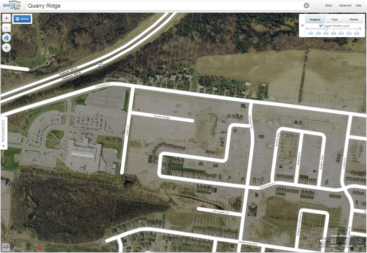
2002 Imagery
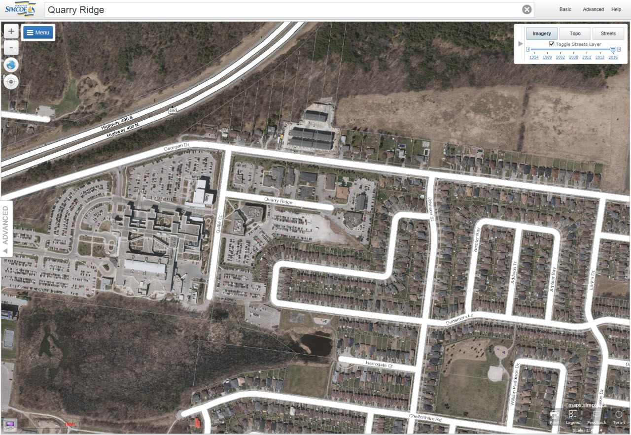
2016 Imagery
2016 Imagery (Streets Layer Disabled)